Sunday, September 30, 2012

Timberline Trail

Sitting at home for nearly two weeks has made me restless. Trying to figure out future plans and watching my friends (who remain on the PCT) post their trail-statuses online feeds to the anxiety that has been building up since my return. I do not like coming home without a plan. I feel like time is wasted when not being used productively. That's why I've been on a research binge, looking for ways to advance my involvement in the outdoor community in hopes of making it not only a lifestyle, but a career someday. But right now is stage 1 of my new chapter, and I'm tired of sitting on my ass, returning to my old unhealthy self. Because it's hard to 'live in the moment' in this situation, I decided to go on a hike! After all, what better way to relax and enjoy the first days of Autumn than to hit the trail and have a couple days to myself... a chance to relax my mind and do what I love before the rain comes.

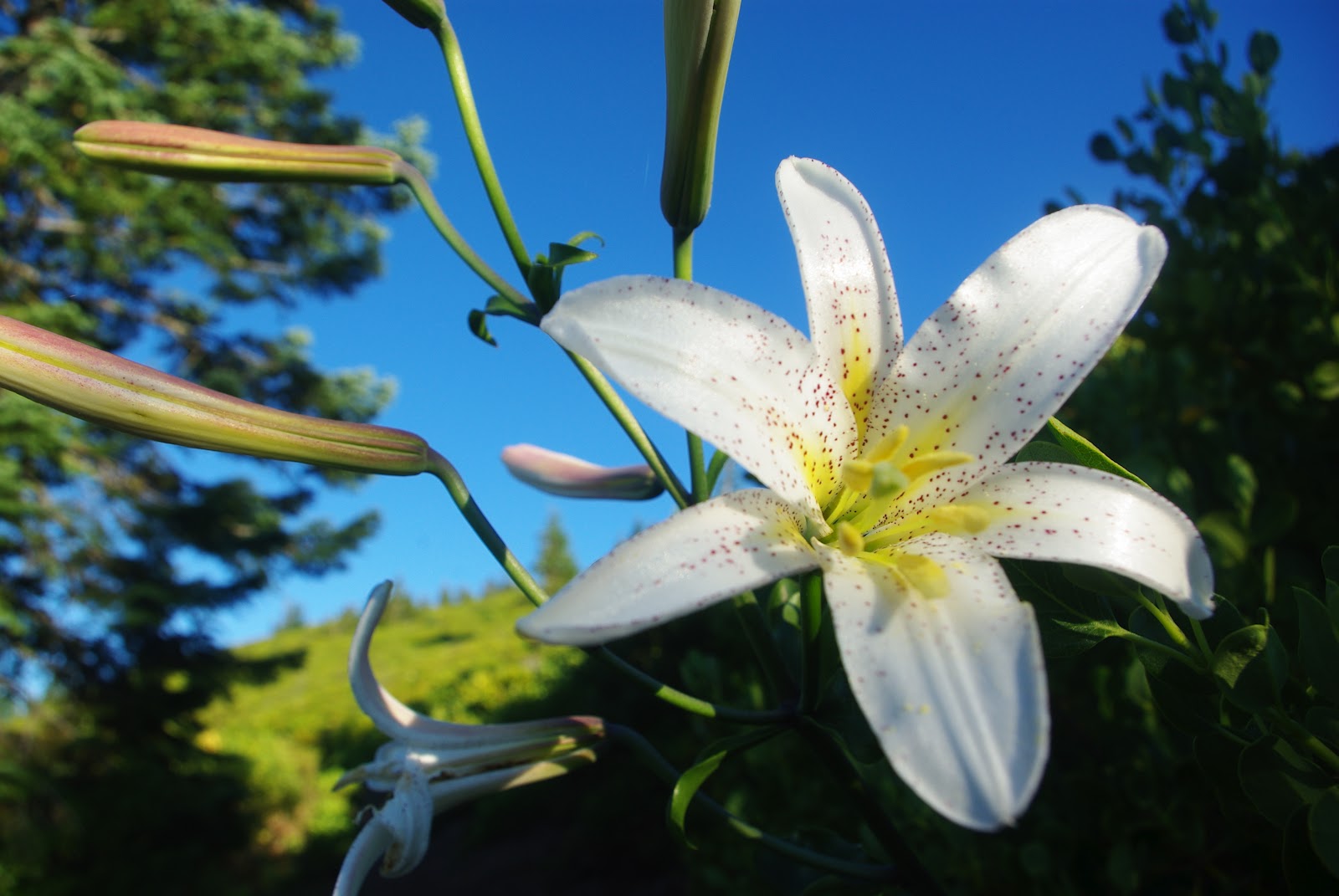
The Timberline trail is a 40.3 mile loop that circumnavigates Mt. Hood. Built in the 1930's by the Civilian Conservation Corps (thank you CCC for building many-a-trail!), its lowest point hits 3,240ft when crosing the Sandy River and it's highest point hits 7,300ft on Mt. Hood's NE side near the old Cooper Spur climbing route. I found the trail to be a fun challenge with amazing views and varying landscapes. It encompasses all a Cascade volcano has to offer including huge glacial carved canyons, swift glacial streams, a variety of foliage (including the abundant Lupine), large burnt areas, soft/sandy trail, volcanic rock, and endless elevation gain. I chose to hike the route clockwise, quickly re-walking the section of trail I had already experienced when hiking the PCT in August, leaving the remainder of the trail as uncharted territory (in my respects). Note: The PCT and the Timberline trail connect for about 11 miles from Timberline Lodge-West. The average backpacker will take about 3-4 days to complete the loop. Earlier this summer, a friend of mine who is an active Ultra-Marathon runner completed the loop in just over 9.5 hours. I decided to walk at my thru-hiking pace and completed the trail in about 15 hiking hours, spread across 3 days.

Mt. Hood's SW aspect near Paradise Park
I left for Timberline Lodge late Thursday afternoon and was trail bound by about 4pm. I started hiking West crossing Zig-Zag canyon which was more difficult than I had remembered. After ascending out of the canyon, you're given the option of staying on the PCT, or to ascend further to Paradise Park. Having the opportunity to experience new trail, I chose the latter and took the 2.2 mile detour through Paradise Park. When I climbed past treeline, gorgeous vistas of Mt. Hood's southwest aspect opened up to my right. The glaciers on this side appeared to have receded since August and a quite calmness had surrounded me unlike my last experience when surrounded by day and thru-hikers. A panorama of the hazy Cascade range was below me as particulate from Central Oregon and Southern Washington wildfires filled the sky. It was getting dark, so I decided to make camp (before descending to the Sandy River low-point) on a sandy knoll with views of the sunset and the orange glow of Mt. Hood's craggy face behind me. I set-up camp 'cowboy style', cooked dinner, and wrote in my journal until the sun disappeared. I remember it being uncomfortable warm even at such high elevation and having a difficult time sleeping because the moon was so bright. I had also lost the ability to sleep comfortably on the ground because I had become accustomed to my mattress upon my return from the PCT. Overall, I probably gained about 2-3 hours of good sleep that night and constantly thought about how this experience (after only hiking 6 miles) was different than being on the PCT with other thru-hikers.

Sun still above the smoky clouds looking SW
The next morning I made the long descent down to the Sandy River, ascended its canyon to Ramona falls, and then continued up and around Bald Mountain to where the Timberline Trail departs from the PCT. This section of trail was most uneventful due to its lower elevations, thicker vegetation, and abundant face-level spiderweb booby traps. However, as I continued up trail, I ran into a group of middle-aged women who looked like they were backpacking as well. After a quick 'hello' and 'good morning', I continued on and wondered why they had such big smiles on their faces. Just 100 yards or so after I passed them, I come upon another middle-aged women not more than 3 feet to the left of me squatting next to a log and fidgeting something with her hands . At first I thought she was picking huckleberries, but after quick observation there were no huckleberries around and most huckleberry plants were done bearing fruit. I then took a closer look but the smell confirmed that she was taking a morning poop, and didn't even bother to hide herself off trail! Throughout my experience I've seen girls pee standing up, I've seen several guys pooping off trail, I've seen men and women skinny dip into glacial lakes, but I have yet to see an old woman pooping in such close proximity to me! As I passed the pooping lady, I heard her group start to laugh and she replied by saying "I know..." in the most embarrassed and vulnerable voice possible. I walked off with a grin and tried to forget about what I just witnessed.


After a while I reached the North side of Mt. Hood and stopped to eat lunch in the middle of a burned area. There was a beautiful little rock shelter off the side of the trail surrounded by black charred trees and black soil. The next several miles were of similar characteristics. Thousands of burned trees, new plant life, smaller canyon crossings and ever changing views of Mt. Hood and the surrounding wilderness. On the mountain, larger glaciers were in view with gnarly looking crevasses. The sound of Pika's chirping in the distance (from the rocks that they live in) was the only wildlife I really encountered. Also, water was abundant on this side of the mountain (almost too abundant) calling for tactical moves when crossing glacial drainage. The trickiest part of the trail would be crossing the washed out Elliot Drainage. In 2006 a large section of trail was destroyed during a storm where today's switchbacks lead to vertical drop-offs making it impossible to cross. Officially this section of trail is closed and hikers are expected to shuttle by car to the other side of the drainage, but shuttling wasn't an option for me and I knew of no detour. When researching about the crossing, people had mentioned of alternate routes (with fixed rope) that bypassed the damaged section of trail. Upon arrival to the situation, I contemplated climbing down the original steep embankment, but decided to find the alternate route that involved less exposure and loose rock. After climbing up the canyon's ridge for about 1/4 mile, I found cairns that led to another steep slope, this time supported by an old weathered rope that lead towards the bottom of the canyon. I chose this route (instead of hiking on and traversing the glacier above the canyon) and easily made my way down to the Elliot Drainage, crossed the stream, and climbed out of the canyon on the opposite side (again supported by another weathered rope) to where the trail continued.

Coming around Bald Mountain looking back


Elliot Drainage Detour

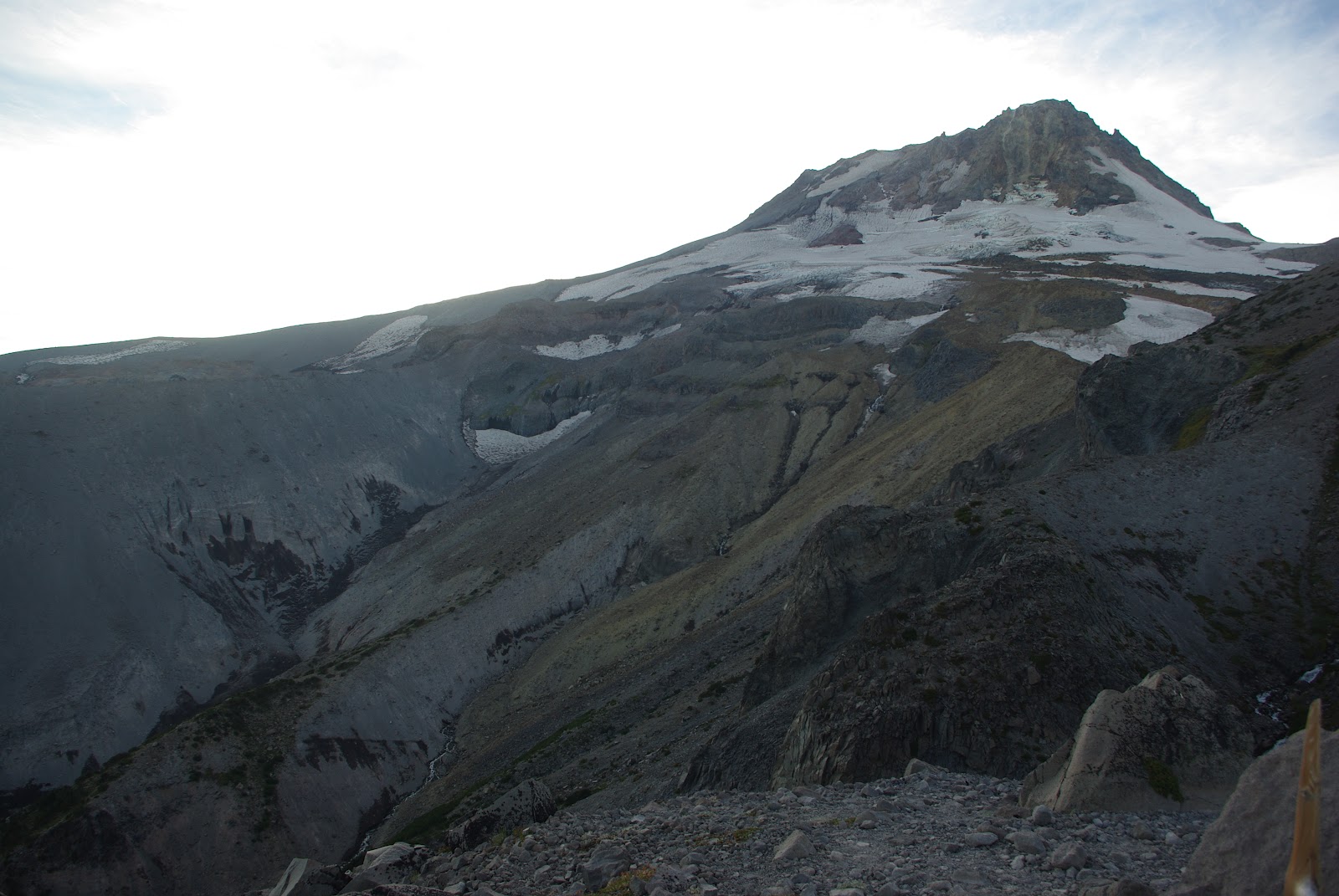
From here on it was a non-stop climb to the trails highest point of Lamberson Spur. On my way up I passed many day hikers who visited the beautiful, but receding Elliot Glacier from the Cooper Spur climbers route. Looking at the Mountains north-northwest aspect, there lay an amazing view of glaciers, snow fields, and vertical crags. I could only imagine what it would be like to summit Mt. Hood via the technical Cooper Spur route, a route with 50+ degree slopes, widely popular in the 1950s and 60s. All the while, the day was coming to an end and as I approached Lamberson Butte after about 10 hours of walking, I decided to make camp on its ridge next to a monster view of the Newton Clark Glacier, its glacial runoff, craggy cliff faces, Central Oregon's high desert, and the hues of the setting sun. I was satisfied for having hiked 25 miles and over 6,000ft of elevation gain, hungry, and ready to sleep. The temperature was significantly cooler that night which resulted in a better night sleep.

Mt. Hood's NE aspect

After waking up this morning, I quickly packed up and headed down and around Lamberson Butte. On my way down I crossed paths with a friend who went to the same college as me, a past PCT hiker, and long-distance runner. He wore no gear but a small chest strap with storage compartments and held a water bottle in each hand. He was running the Timberline Trail in the opposite direction as I, and was expected to complete his run in 10-12 hours. After a brief conversation we went our separate ways and I continued with my slow backpacking pace clockwise into the non-wilderness/ski resort lands of Mt. Hood Meadows and Timberline. Before I reached Meadows, I had to cross a couple of pretty large but entertaining canyons with glacial drainages. Upon reaching the ski lifts, I passed by 3 different hunting parties and recall my father mentioning that it's opening weekend for deer hunting in Oregon. I thought it quite dumb to be packing rifles in the middle of a ski resort, on the Timberline Trail with other hikers, and on such a small section of allowable hunting land (national forest). From then on I kept on high alert for any gun toting, slow moving, slightly obese people walking towards me :)

Looking North towards Mt. Adams above smoke
One of the many canyons the trail crosses (at lower elevation)

It wasn't long after crossing Mt. Hood Meadows ski resort that I neared Timberline Resort. After all, from the Meadows side of White River Canyon, you can see a large section of Timberline's Palmer ski lift. The last fun obstacle before the sandy ascent to Timberline lodge was crossing the White River drainage. It reminded me of crossing the (coincidentally named) White River canyon near Cabazon, CA when hiking the PCT, but a lot smaller. Mt. Hood's White River drainage was at the bottom of the large canyon that separated the two resorts and consisted of a large flat rocky riverbed that was marked with cairns. Before entering the drainage, a sign read something like "Caution: Dangerous glacial run-off ahead" which got me excited. Shortly after finding my way across, the Timberline Trail once again joined the PCT and continued up the canyon's sandy ridge to the resort where my car was waiting.

Hiking the Timberline Trail was a quick but rewarding experience. I enjoyed the pleasures of hiking solo but would have also enjoyed sharing the experience with others. I also got the chance to view the Mt. Hood during an interesting time of year and witness the affects that climate change has portrayed on its alpine environment. At the very least it got me off my ass from two weeks of post PCT delirium.

Tuesday, September 18, 2012

PCT Trip Summary

As I sit here in my parent's comfortable air-conditioned house, I find it difficult to completely rehabituate into civilization and American society. The past 4.5 months have been an amazing and unique experience that I deeply enjoyed. It compared to no previous adventure of mine; partially because it combined the art of travel with demanding physical activity, but also because I was exposed to the elements 100% of the time. Living with nature and its changing landscapes was liberating. Meeting like minded outdoor enthusiasts was also a perk. The experience liberated me from past restrains keeping me from pursuing and acting on my instincts.


Pictures: Me at the Mexican/US border, look at that noob! Me at the US/Canadian border with my victory cigar!

The PCT provided an opportunity for me to live freely and simply: I wore one set of clothing over the entire trail. I ate cheaply. I spent long periods of time between showers (because they were unnecessary) sometimes going 10-15 day stretches without properly 'cleaning' myself. I haven't shaved my face for almost 5 months, letting it grow into its natural AmeriEuroPino complexion that it is now. I slept under the stars every night, sharing the desert or forest floor with the other living creatures. I lived by the sun, waking up to its rise and falling asleep when it set (for the most part). My goal was Canada, and my days consisted of only one simple exercise; hiking.

Hiking from Mexico to Canada provided me the opportunity to experience the land in context of the human body and it's limitations. Sometimes I felt like I was in sync and in harmony with the surrounding landscape, sometimes I felt disattached. Sometimes I felt like I didn't belong to the particular landscape, or there was no purpose for me being there. However, most times I felt like I was more adept to be living in 'wilderness' compared to living in the city. Regardless if there was any meaning or purpose of hiking the trail and living with nature, I thoroughly enjoyed the experience and am forever grateful of what the experience had provided to me. That's the least I can say about that.

When hiking through the Glacier Peak wilderness, I contemplated a ridiculous questions that thru-hikers are asked quite frequently: Why do you hike?
Though there surely are a variety of ways to answer this question, my response would be: I hike because each changing view proposes a dynamic perspective of distance, time, and aliveness... That, combined with all other external factors (e.g. the elements and the interaction between each element) catapult the human mind into a state of harmony with nature, hence the reason why, in my belief, people enjoy it. There's nothing like climbing a mountain pass from lower elevations: it's vegetation starts thick, grabbing at your legs and waist. The trees block out the sky and you're surrounded by a hodgepodge of busy greenery. Once you reach mid elevations, you can observe the thorny plants and brush starting to thin. By this time, I usually work up quite a sweat, but after passing the tree-line, you're rewarded with the first of many dynamic views. Just when you think your body is fatigued and can't climb any faster, you reach the mountain's saddle combined with what I call an "ahh-se-veynia" moment as a gust of wind greets you with a refreshing sense of accomplishment. "Ahh-se-veynia" because you feel like baby Simba in the Lion King when he's hoisted above the animal kingdom, suspended over a cliff's edge for all to see.

In-parallel with the PCT's nature experience, I met the most amazing people unique to the trail. All had their own stories, backgrounds, and reasons for hiking, but the bond that we created while hiking was pure and real...Where else do 6 different people fart in harmony together, or where else can you camp and socialize with like-minded, nature loving folk for months on end? I'll never forget.

I'll leave you with this:
Buck (PCT 2010) mentioned in his Journal somebody's response after crossing back into the US at the US/Canada border just after finishing her thru-hike. She said "I heard the burly man in his late-thirties shout at me-----NEXT!!----- as he waved me over towards him. I gave him my passport, and then he asked: 'and what was the purpose of your visit to Canada?' Honestly, I tried hard-----so very hard-----but I couldn't help but tremble. My eyes watered-up, and I heard myself say: I walked here. I walked to Canada. I walked to Canada from Mexico on the Pacific Crest Trail."
 It's funny reading this after-the-fact because the exact same thing happened to me just 4 days ago.

Trip Statistics:

Start/End Date: April 27th (Friday of PCTADZKO) through September 13th
Total Days: 140 (4 months 17 days)
Zero Days taken: 11 (Zero days are where 0 PCT miles are hiked, though off trail miles may still be hiked, e.g. finishing the JMT into Yosemite Valley)
Nero Days: A handful (days where about 15 or less PCT miles are hiked)
Miles Hiked: 2,660 trail miles plus about 100 off trail miles
Base Weight: Probably anywhere from 13-15lbs depending (I carried a 3 lb camera)
Maximum Weight Loss: 15lbs (I went from 165lbs to 150 after a few months, then gained some back)
Days of rain: 0
Nights of rain: 1.5
Miles walked on snow: Probably a combined max of 1.5 miles. We got lucky this year!
High Point: 13,200 ft (Forester Pass), though I sumited Mt. Whitney which was 14,505ft
Low Point: Cascade Locks (near sea level, about 240ft)
Start/End: Mexican/US border fence near Campo, CA & Canada/US border near Manning Park, BC
Average miles hiked per day: 25-30 (max day hiked was 36mi)
Number of Thru-Hike Attempts at start: about 700, but this number is questionable based on the number of people who attended the PCTADZKO, registered for thru-hiking permits, etc.
Number of successful thru hikes: Not sure, I'm guessing 200+ people will successfully complete a thru-hike this year
Hiking Partners: 3-Bears (Desert 700 miles), Ant Eater (Kennedy Meadows to Canada, about 2000+miles), Pilfer (Belden to Canada, about 1300 miles). Honorable mentions: Ben Tucker, Beef Nugget and Smiles, The Three Caballeros, Houdini, Gully, Robin Hood and Tortuga, El Capitan and Cool Ranch and the rest of Team Fuck-It, Fig, Nancy, Scott, Calf and Ruby Locks, Data, Scrambled Legs, Good Times, Scarecrow, Sanjay, and many, many more! 

Mexican/US Border

Typical So-Cal Trail Blaze

Headed towards Warner Springs and perched on this rock 

On our way to Big Bear w/ 3bears and Pop Star

Sleepy hiker trash

Greeted with this inspiring sign before the High Sierra

Atop Mt. Whitney in the Sierra Nevada range

Diving into an alpine lake at Muir Pass around 11,000ft

Hike naked day: June 21st

Ant-Eater and Dirty Brown kickin' outside Tuolomne Meadows

One of my favorite camping spots just before Senora Pass (northern part of the high Sierra)

Sunset at Senora Pass

PCT midway point

Sleepy hiker after a big day crossing Hat Creek Rim (huge waterless stretch)

Getting spoiled by trail angels at Honker Pass (don't mind the creepy beard)

Wild Lilly 

Hitching into Shasta... didn't work to well this time

Last stop in California, or should I say the State of Jefferson!

Rimmin' at Crater Lake

Beautiful Crater Lake

Oregon: most of it burned

Goat Rocks Wilderness is EPIC

Data and Pilf, Olympia vs Schmidt..

Awww moment in the Glacier Peak Wilderness

Sanjay thinking he's a penguin at Mica Lake in GPW

The only sketchy part of the entire PCT was this river crossing

Bus ride into Stehekin was quite entertaining

Beautiful and scenic North Cascades

My last journal entry

Look mom, I made it to Canada!


Saturday, September 15, 2012

Made it! Mile 2,660, Day 140


I'm finished thru-hiking the Pacific Crest Trail! WOOOO WHOOO! I have a lot to talk about, but no time to write an appropriate blog update in the Vancouver, BC library.. Therefore, I will write a formal trip summary when I return to Portland. That being said, here are a few things to say:

Trip Length: 2,660.1 Miles +extra miles during resupply/JMT
Duration: 140 days (April 27th - September 13th 2012)
Days of rain (while hiking): 0
Nights of rain: 1.5
Finished with: Ant Eater, Pilfer, Sanjay, Good Times, Scare Crow, P-Trak, Cruiser, Banana Pants, Barracuda & Sparrow (youngest to ever thru hike the PCT at 7yr old), and more totaling to about 15 people that day.
Current Location: Vancouver, BC, CA
Morale: Stoked
Next Trip: TBD

One of many photos taken at the monument!


Group (w/ Angel Larry) heading out of Stevens Pass
Most 'seedy' hostel experience I've had in a while haha (Vancouver, BC)

Thursday, September 6, 2012

Skykomish, the Dinsmores, mile 2476

As we head back to the trail (Larry is awesome for hooking us up with rides), I reminisce how amazing our short time at the dinsmores was. Our last trail angel stop was great and now we head towards the last resupply town of stehekin before Canada. Beautiful country and mountains ahead of us all the way to the border. Still no rain!

Sunday, September 2, 2012

Mile 2402, halfway through Washington

Ive hiked through some amazing terrain through Washington wilderness with amazing views of mt Adams mt St. Hellens and mt ranier. Huckleberries are in bloom and the skys are mostly sunny. Its getting cold tho, and the terrain is getting challenging.  I'm excited to hit the hills again this afternoon north of snoqualmie where some people say it looks like middle earth. Only 250 ish miles left.. this trip is going by way to fast. I'm glad the section coming up is going to be atomic!

Pic : goat rocks wilderness